


Low pressure system in Bay of Bengal likely to intensify into a cyclonic storm


.png )
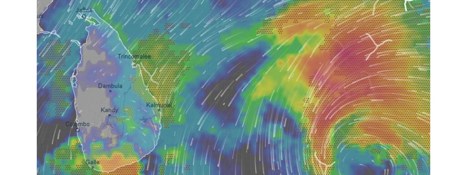
Colombo (News 1st); The low-pressure area in the south-east Bay of Bengal has concentrated into a depression lay centered 750 km southeast to Trincomalee.
The system is very likely to intensify into a deep depression during the next 12 hours and likely to intensify further into a cyclonic storm during the subsequent 12 hours .
This system is very likely to move west-northwestwards and cross the eastern coast of Sri Lanka between Batticaloa and Mullativ around Wednesday (02) evening.
WARNINGS:
For Sea Area - Under the influence of the aforementioned system, from 01st December to 03rd December;
Intermittent showers or thundershowers and sudden roughness, associated with a sudden increase of wind speed up to (80-100) kmph are expected over Eastern and Northern deep and shallow sea areas.
The shore off the coast extending from Kankesanthurai to Pottuvil via Trincomalee and Batticaloa may experience surges due to the effect of swell waves, having (2.0- 3.0) m height.
From 02nd December to 03rd December;
The sea area around the island will be very rough to high as the wind speed can be increased up to (80-100) kmph at times.
The shore off the coast extending from Batticaloa to Mullativ may experience surges due to the effect of swell waves, having (2.0-3.0) m height.
For the Land area -
The general public is requested to be vigilant regarding impending extreme weather situations.
For emergency assistance contact the local disaster management authorities.
Requested to be attentive about future advisories issued by the Department of Meteorology in this regard.
Other Articles


Featured News

-785316_550x300.jpg)


News 1st, MTV Channel (Pvt) Ltd, MBC Networks (Pvt) Ltd, 45/3, Braybrooke Street, Colombo-02.
T.P : +94 114 792 700,
Fax : +94 114 792 733
T.P : +94 114 792 700,
Fax : +94 114 792 733


 |  |  |
|---|---|---|
 |  |  |
 |  |  |
 |

.gif)